

“Podilya’s Tovtry” National Park
National Park was formed in 1996 on the territory of Kamyanets-Podilskiy, Horodok and Chemerivtsy districts. It occupies 261,32 hectares which is 12,5% of the whole territory of Khmelnitchinna. It is one of the largest National Parks in Europe.
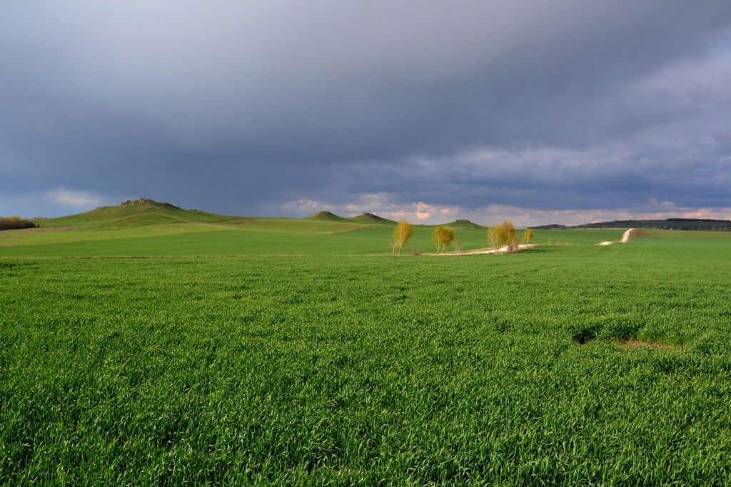
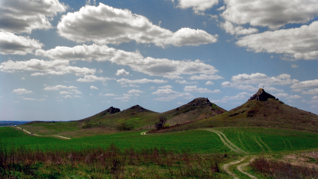
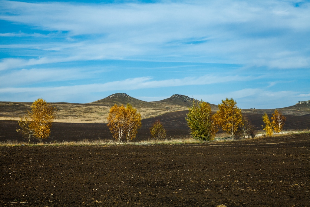
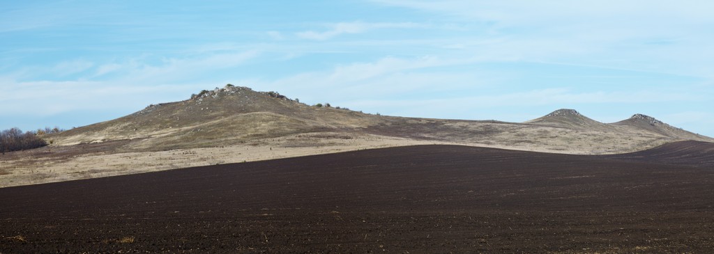
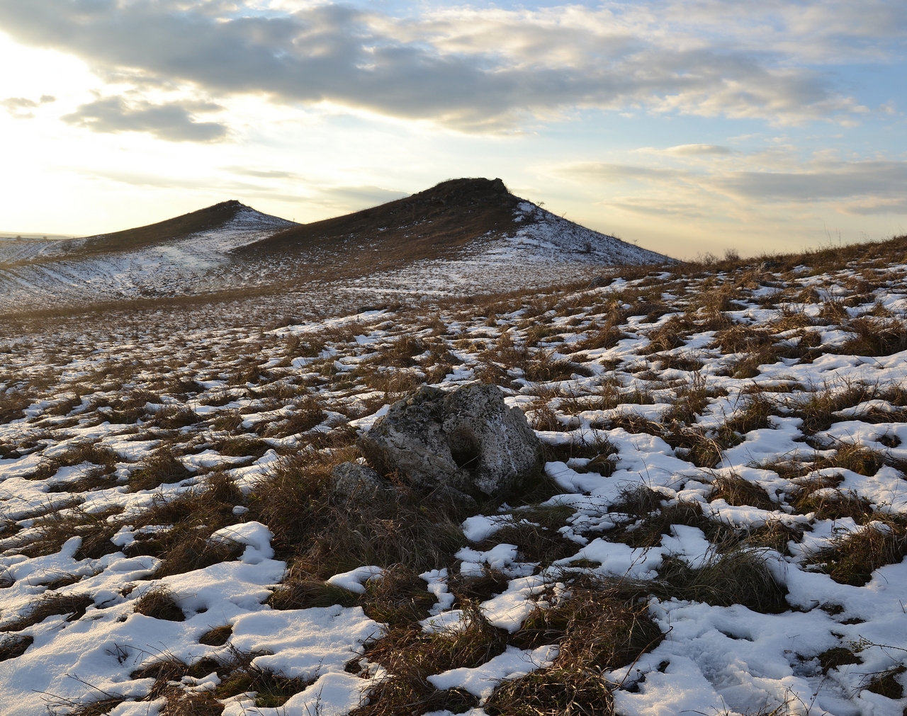
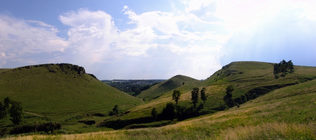
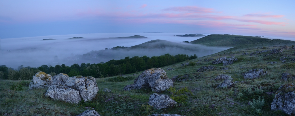
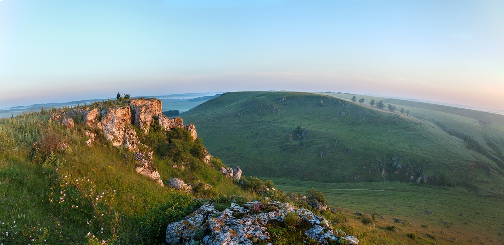
Tovtry range is a unique geological formation of its kind which appeared around 25-14 million years ago. The height of the range varies from 350 to 400 meters and hides Pridnistrovya from northern and north-eastern winds. As a result, it forms warm climate close to subtropical favorable for thermopile flora. There are 1543 species of vascular plants growing in the park and 76 of them are listed in The Red Book of Ukraine.
Fauna is represented by 366 species, names of 80 of them you can find in The Red Book of Ukraine. A lot of species are under the protection according to Bern’s Convention.
You can be amazed by vivacious life of numerous birds, animals, reptiles, insects and many other living creatures existing in the park. Scientists are always attracted by flora and fauna of the park to make their researches.
Podillya’s Tovtry and the Dnister Canyon are among seven natural wonders of Ukraine.
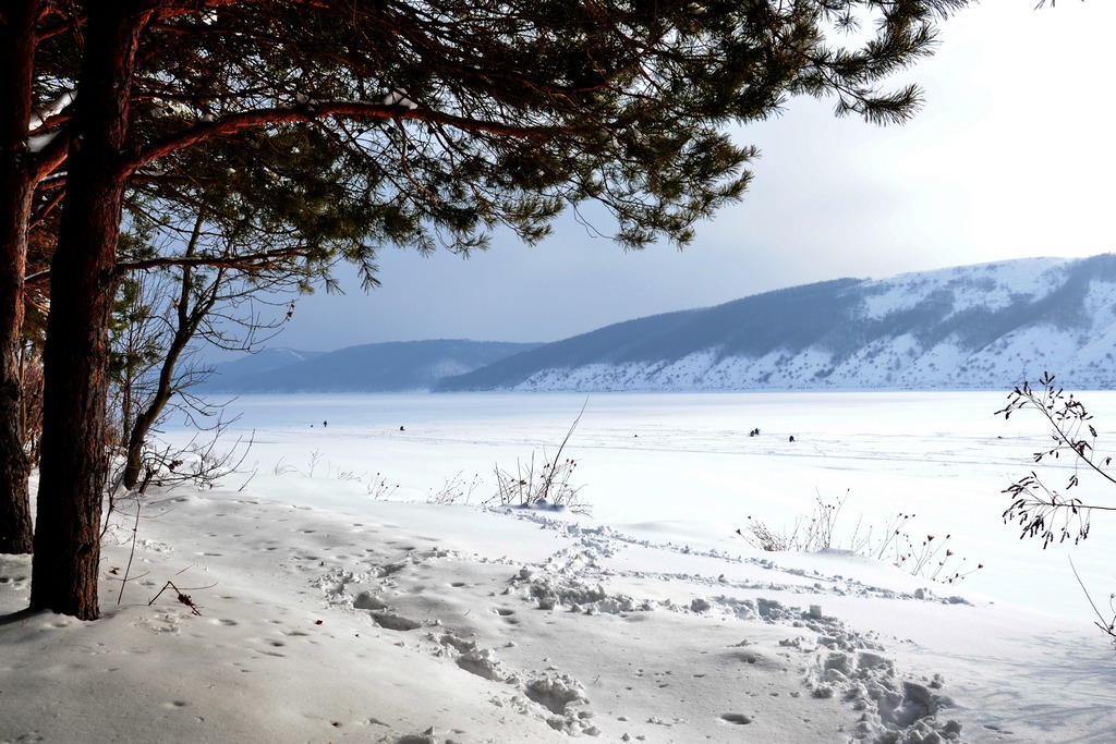
BAKOTA’S BAY is water and marshy object of area of economic significance on the territory of “Podillya’s Tovtry” Natural Park. It is situated near the villages of Horaivka and Kolodiyivka fifty kilometers to the south-east of Kamyanets-Podilskiy. It occupies 1590 hectares.
Bakota’s Bay is situated in the canyon of the Dnister. In 1976 the lowest part of the river was flooded during the erection of the Dnister’s basin. The bay looks like a horseshoe. Most of its slopes are planted with forests. The banks of the bay are steep, in some places even rocky. The riverside is covered by pebbles and Breakstone chips.
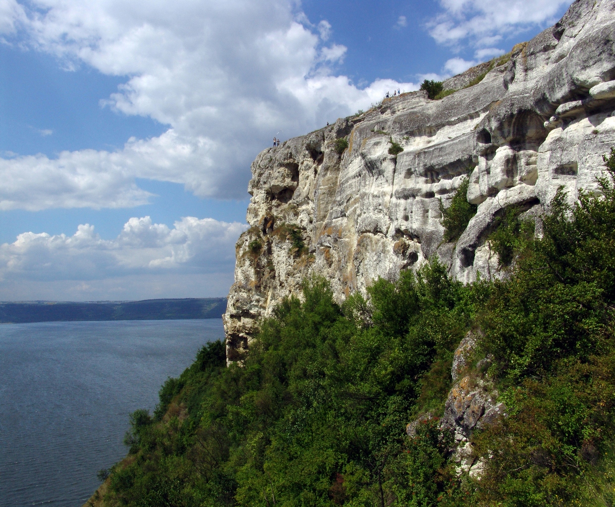
White Mount, which is 30 metres high above the bay and the Dnister, is formed by hard limestone. On top of the mount there is a chimerical cliff called Stone Head because of its resemblance with a man’s head. Cliffs surrounding the bay cause special subtropical climate.
The depth of the bay is 34 meters and the width is 1700 meters. During floods water can go 6 meters up but never overflows the banks of the Dnister Canyon. Springs and streams from surrounding limestone cliffs flow down into the bay.
This territory is of great importance for protecting wild birds and fish breeding grounds. It is the habitat for spring and autumn birds’ migrations of the water-marshy complex.
Under the waters of the Dnister’s basin an ancient town of Bakota was flooded. The name of the town means “desired wonderful place” in Old Russian language. Bakota was the ancient capital of Ponizzya (Lowland), the region between the Dnister and the Southern Buh existed in 13th-14th centuries.
One more feature special for the bay is a cave monastery in the cliff of White Mount which was built in the 11th-13th centuries by first Christians on the territory of former heathen sanctuary. One of the caves has remains of sacrificial place from Bronze Age, II millennium B.C.
The depth of caves inside the cliff is 7- 9 meters and the total area of the monastery is about 760 square meters. It consists of three caves and cells in two levels. The biggest one is a church. This place is also famous for its clear springs with healing waters.
History of the monastery is quite tragic. It was ruined by Tatars when it was 300 years old and later it was buried under the rock fall in the Middle Age. In the 19th century it was dug out partially by archeologists and the monastery renewed its service. During the years of the soviet regime it was demolished several times.
Independent Ukraine helped the monastery to rebirth the feast of Maccovia on 14th August. There are a lot of ritual towels and icons of different confessions in the cave church. Bakota has become the place for holding spiritual practices and ceremonies of numerous religious movements’ followers. It is also a popular tourist destination and an exciting place for recreation.
Today Bakota’s Holly Mikhailo’s cave monastery is one of the biggest and well-preserved cave monasteries of Pridnistroviya. It is of national value. And as a result, combination of landscapes’ natural beauty, mysterious history and healing features of this area makes it a real pearl of Podillya’s lands.
PONIZZYA (Lowland) OF THE SMOTRYCH RIVER is water and marshy object of area of international economic significance of “Podillya’s Tovtry” Natural Park which is situated between the villages of Tsibulivka and Ustya of Kamyanets-Podilskiy district, 15 kilometers to the south of Kamyanets-Podilskiy. Its total area is 1480 hectares.
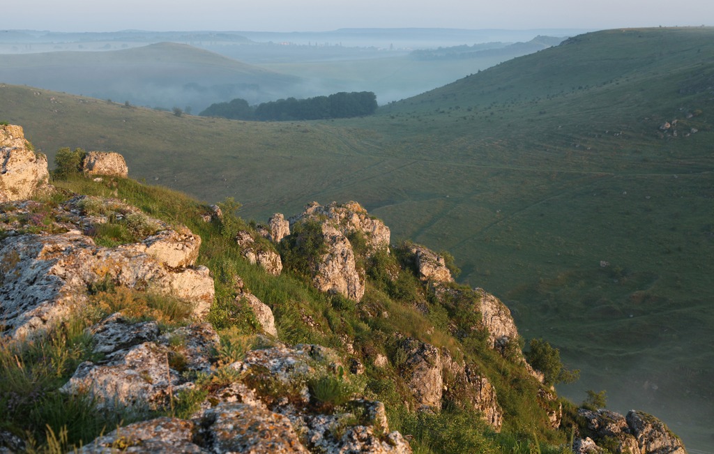
The territory combines the canyon and the Smotrich river delta before it inflows into the Dnister. The canyon of the Smotrich is a unique geological formation of great scientific and amenity value with its steep cliffs up to 80 meters high.
THE SMOTRICH’S CANYON is a geological natural sanctuary of state importance which is situated between the villages of Holoskiv and Zubrivka in Kamyanets-Podilskiy district. It also goes through the town of Kamyanets-Podilskiy. The length of the canyon is 9 kilometers and the total area is 80 hectares.
The canyon in Kamyanets-Podilskiy is a unique landscape of its kind in Western, Central and Eastern Europe. The Smotrich forms a meander loop and a rocky peninsular with total area of 121 hectares which became the territory to set up an ancient town. Kamyanets-Podilskiy represents harmonious combination of exceptional historic, architectural, geological and botanical objects. That is why the town is called “Flower on the rock”.
A lot of springs flow down the steep slopes of the canyon. There are permanent and seasonal waterfalls running down near the New Plan’s bridge.
Few bridges connect two banks of the river and the highest one in Ukraine is called “Dashing fallow deer”. Tourists enjoy flying in hot-air balloons over this bridge and more daring people try bungee-jumping from it.
KITAYHOROD’S OUTCROP is a geological natural landmark of state importance in the south-western boundary of the village of Kitayhorod. Its total area is 60 hectares.
Exceptional geological earth formations are represented here by local nature which have one-hundred-meter vertical walls on the left bank of the Ternava river (the Dnister’s left tributary) with the total length of 1,2 kilometers. Old cobbled road, which is the remainder of medieval main road, leads to the geological landmark called Chumatskiy Shlyakh (road).
Kitayhorod’s wall is the only one within East-European platform with 400-600-million-year-old extraordinary outcrops that contain numerous fossils of plants and animals such as corals, cancers and ostracoderms. Few relict plants like Schiveréckia podólica, Pulsatilla nigricans and stipa capillata grow there on the hillsides.
On top of the cliff there is the Blessed Virgin Mary cathedral built in 1772-1776 in late renaissance style with Baroque elements. Behind the cathedral you can notice ruins of Andriy Pototskiy’s mansion. Some more remains of ancient settlements of Tripillya’s (three-field system) and Old Russ times were found on the territory of Kitayhorod.
“ATLANTIDA” CAVE is a geological landmark of national importance with total area of 10 hectares and length of more than 2,5 kilometers.
The cave is situated on the upper level of the left hillside of the Zbruch (left tributary of the Dnister). The entrance to the cave is 8 meters above the surface.
Atlantida is a flat-dipping gypsum cave relating to karstic formations of labyrinthine type. It is one of the most amazing karstic caves of the world.
The cave is situated in the twenty-five-meter thickness of gypsum anhydride layer with its depth of forty five meters. The cave has three-level structure. The lowest level has high and wide galleries, the middle level consists of one-meter bags and the highest one has two five-meter tall passages. On the galleries’ crossing of low and middle levels 30 halls are found and few of them are quite large. Corridors go into narrow holes, crossing of different ways form complicated labyrinths and there are some switch backs in them.
“Atlantida” cave is called a natural mineralogical museum because of its colour and shape crystal diversity. Gypsum crystal sizes vary from several millimeters to 1,7 meters. Crystals look like leaves, bunches of grapes, flowers, colorful garlands and mythic creatures. Under the light they twinkle and glitter in different colours and look miraculous.
Two more huge halls have been found recently and called “Conciliarism” and “Easter”. They have also dug out fragments of pre-historic cave bear there.
Atlandida has its own climate with a temperature of +12,00 C during the whole year and relative degree of humidity is 99-100%.
The cave has a great scientific, geological, natural, educationally cognitive, therapeutic and esthetic importance. You can visit it only with a skilled instructor.
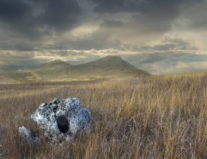
KARMALYUK’S MOUNT is a landscape reserve of national importance and it is situated between the village of Makiv in Dunayivtsy district and the village of Kolubayivtsy in Kamyanets distict. It has the total area of 765 hectares.
The reserve consists of the forested mountain range on the left bank of the Muksha (the Dnister tributary). Karmalyuk’s Mount is 60 meters high above the surface and bended round by the river on both sides. It is of great interest among scientists who study the variety of plant species.
West and north-west hillsides have very steep cliffs which are over 10 meters high. At their bottoms there are huge rounded field stones covered with rare species of moss and fern.
In V- IV centuries B.C. this land was a location area of the Scythian fortification and in VII-VIII centuries A.D. there was a Slavic settlement there. These facts are stated on the stele placed on the territory of the reserve.
The name of the mount is connected with Ustim Karmalyuk , a national hero, who according to the legends, stayed in its cave.
KNYAZHPIL’S RESERVE is a landscape reserve of national importance near the village of Knyazhpil in Kamyanets-Podilskiy district with the total area of 821 hectares.
It has a grand forest with enormous oaks, beeches and one-hundred-and-fifty-year-old pines. Animal and vegetal life is rich in rare species inhabited here.
Steep cliffs have numerous caves and grottos. The most famous fifteen-meter picturesque chalk-stone cliff is called “Falcon” and it is of the same age as Miocene. Its contours remind us a falcon’s head.
OWL’S RAVINE is a landscape reserve of national importance near the villages of Vihvativtsy, Krushanivka and Patrintsy in Kamyanets-Poidilskiy district with total area of 827 hectares.
It’s a complex of forested canyon-like hillsides of the Studenitsya river (the Dnister’s left tributary) with shrubberies and steppe areas. Here you can find karstic caves “ Temnik”, “Molochniy kamin” and the spring called “ Sova krinitsa”. Forests of this reserve consist of different types of trees and they are the habitat for numerous birds. Some of them are listed in the Red book of Ukraine.
Because of the scientific importance and amazing beauty of the landscape this reserve is often called Switzerland of Podillya.
MOUNT SAMOVITA is a botanic natural landmark of national importance in the north-west of the village of Zalucha in Chemerivtsy district with total area of 15 hectares. Mount Samovita is the only one in the Tovtry range which has its primary state of nature. It is not forested and has steppe and rocky vegetation.
Rare flora is represented by several species listed in the Red book of Ukraine and the world.
This mount has a moat around which helps to protect it as well as its status of national reserve.
IVAKHNIVTSY’S RESERVE is a landscape reserve of national importance which is situated on the territory of the “Podillya’s Tovtry” National park. It is situated near the village of Ivakhnivtsy in Chemerivtsy district with the area of 155 hectares.
The reserve includes such mounts as Kolomiyka, Rublikha, Serednya, Panska, Nemozhna, Visoky Kameny, Baba, Sokolikha, Ian, Valiv Pyets, Sasikha, Kutsikha, Kozachkova pasika. These mounts have steppe and rocky vegetation with few rare species listed in the Red book of Ukraine. Thirty five bird species are registered in the reserve and they are under the state protection.
MIKHAILIVKA’S PARK is a natural landmark of park and garden art of national importance situated in the village of Mikhailivka in Dunayivtsy district with the area of 15 hectares.
The park was made in the mid 19th century around the palace which was rebuilt from the fortress of the Makovetskies, Polish landlords. During many years members of the family took an active part in administration of state affairs in Poland as well as in Podillya. Henry Senkevich, a famous Polish writer, worked in the palace library choosing the material from the archives for his trilogy “ Ogniem I mieczem” (“With Fire and Sword “), “Potop”(“Floodd”) , “Pan Wołodyjowski “.
The last owner of the palace was a famous botanist Stefan Makovetsky who gathered one of the biggest plant collections in Ukraine including orchid, citrus, banana and other exotic for the area trees, bushes and plants.
During the years of the civil war the mansion was destroyed, the palace, the orchard house and household buildings were demolished.
The park is divided into two parts by the motorway. The eastern part is the main one and here you can find ruins of the palace, an original stone grotto with spring water and a pool called “Inspecty”, a pond with an island and old trees. In the western part on the steep hill there are black pines and juniper.
The park has 109 tree species with outstanding maidenhair tree which is 160 years old and the oldest one in Ukraine, tsuga Menzisa, candelabrum-like fir-tree, silver fir and others.
The park is a favorite place among locals and tourists.
Фото